Greetings,
While I was playing around with the MeshMap on one of my nodes, I got an interesting idea to somehow output a KML file for Google Earth. I started writing a python program to go thru the MeshMap SQL database and build a KML file.
This is what I've got, so far:
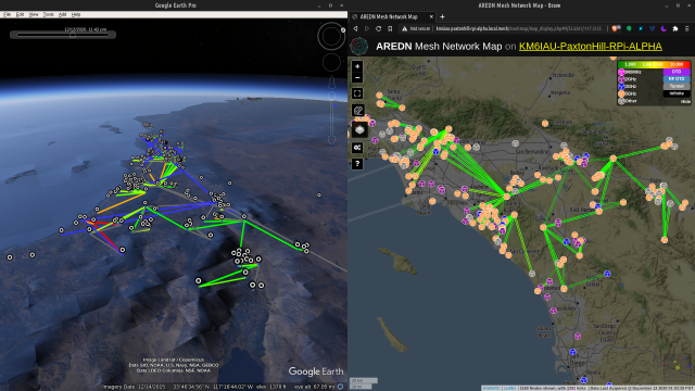
The nodes are generated from the "node_info" table, and the links are generated from the "topology" table. I've not been able to determine how you identify between a RF connection, DTD connection, and tunnel connection. I thought it was by "cost" (in the "topology" table), but that doesn't seem to be it. There are apparently RF links with a cost of 0.1 and 1.0, which i thought might be dtd and tun, respectively.
I guess the "feature request" part of the subject would be to have get-map-info.php optionally churn out a KML at the end. Ha. Programming is always easier when someone else does it. haha.
Again (but in a suitable thread this time), this is really great (and well designed) resource to the ham community, so thank you for your hard work.
You are here
Question about Meshmap and/or Feature request
Sun, 12/13/2020 - 04:30
#1
KM6IAU

Question about Meshmap and/or Feature request
Theme by Danetsoft and Danang Probo Sayekti inspired by Maksimer